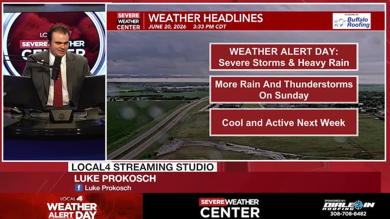
Weather Alert Day for severe storms and flash flooding
Saturday June 20, 2026 Evening Forecast
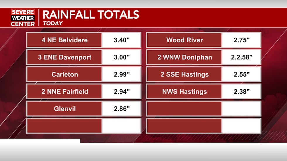
HASTINGS, Neb. (KSNB) - Good evening! We’ve already had plenty of showers and thunderstorms moving through the area, with reports of 2 to 3 inches of rain in parts of the Tri-Cities. We’ll have rain total updates here through the evening.
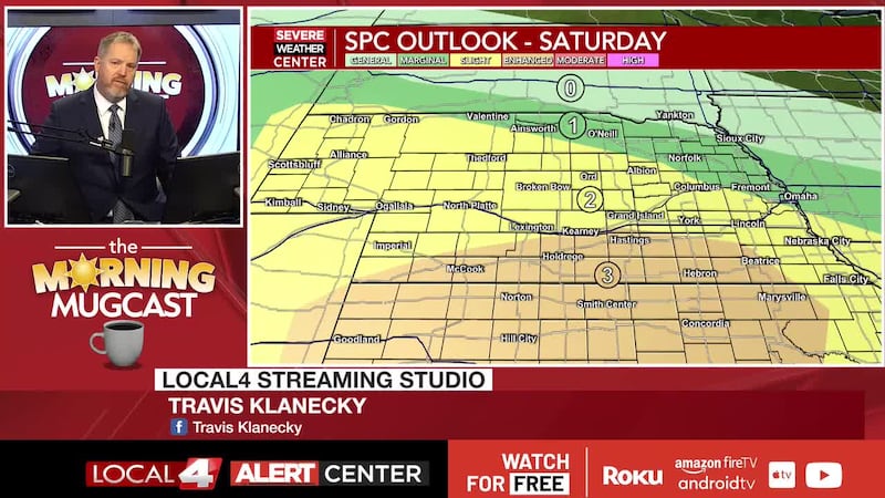
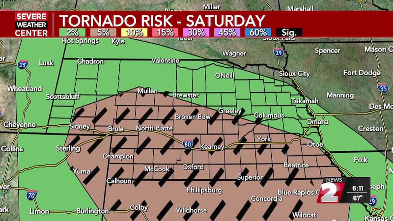
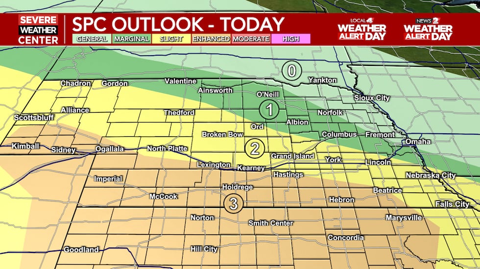
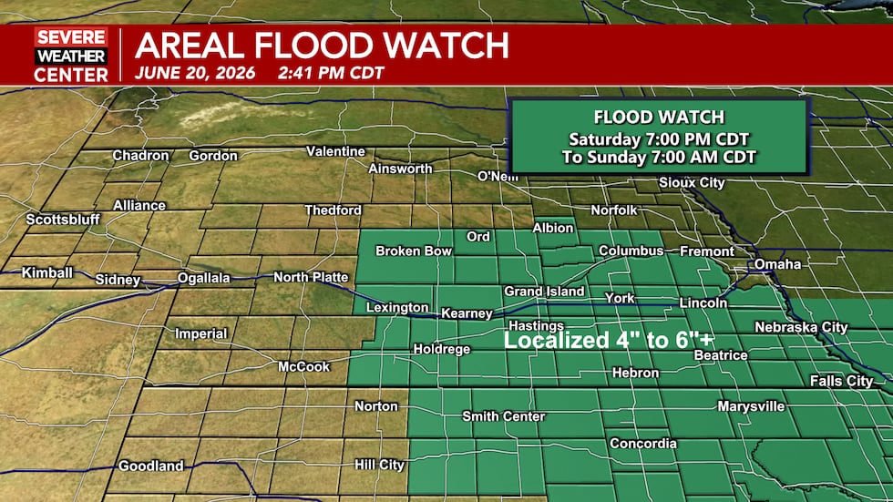
Weather Alert Day: The Weather Alert Day continues for both KSNB and KNOP. The first round of storms is still ongoing across central and eastern Nebraska. We’ll be watching areas to the west for more development through the afternoon into the evening. An enhanced risk (level 3 of 5) remains in place for southern Nebraska into Kansas, with a slight risk (level 2 of 5) for areas north of that. All modes of severe weather are possible, but a damaging wind threat will become more apparent into the evening hours, especially along and south of the Nebraska/Kansas state line. Multiple rounds of showers and storms will continue through the night into tomorrow morning as a flash flooding threat will become more apparent. Heavy rain is likely in these storms, and we could see areas get around 2 to 5 inches of rain between now and Sunday afternoon, with some isolated higher amounts. A flood watch remains in effect through tomorrow morning for much of central and eastern Nebraska into northern Kansas.
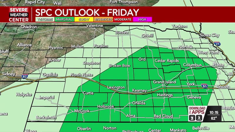
Father’s Day: Morning showers and storms clear out leading to a fairly dry afternoon. Temperatures remain cool in the upper 60’s to mid 70’s for most, but areas to the southwest could see temperatures into the low 80’s. Those are the areas with the highest threat for severe weather tomorrow as a slight risk is in place, with a marginal risk for the rest of the area. Scattered showers and storms are expected to develop to the west tomorrow evening, and move east southeast into the overnight hours. Primary threats with these storms will be damaging winds and large hail.
Next Week: Temperatures are expected to stay cool in the low to mid 70’s for much of the work week. With this cooler stretch of weather we’ll see an active weather pattern continue with on and off shower and storm chances throughout. Currently the severe threat appears low, but this time of year you cannot rule out gusty winds or large hail with any storms. We do expect a warm up into next weekend with highs back in the 80’s and much drier conditions.
Click here to subscribe to our KSNB Local4 daily digest and breaking news alerts delivered straight to your email inbox.
Copyright 2026 KSNB. All rights reserved.